City Heatmap Poster: Every Run You've Done, One Artwork
A single-race poster tells one story. A city heatmap tells all of them: every street you've claimed, layered into one map where your regular routes burn bright and the one-off explorations trace the edges. It's the closest thing to a fingerprint your running has.
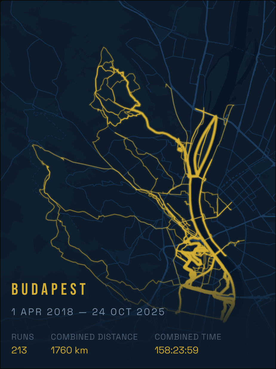
Most route-poster services can't make this — they're built around one GPX file at a time. Here's how to do it with your whole Strava history, in about five minutes.
Step by step
- Open runink.app and pick the composite mode. That's the "all my runs" option, as opposed to a single-activity poster.
- Connect Strava. Your full activity history loads directly — no exports, no uploads.
- Filter to a city. Runs are grouped by where they actually happened, so "every run in Budapest" or "my London years" is one click, even if your history spans continents. Date filters let you cut it to a single year — "Berlin 2026" makes a great year-in-review.
- Style it. Pick a theme (from minimal ink lines to bold night-mode palettes), a size, and a title. Where routes overlap, the layering does the work — your daily loop will glow.
- Export or print. The high-resolution file is free, delivered by email. Or order it as a matte print — from $32 (£24.99 in the UK), shipping included — and it arrives ready to frame.
Sizes and prices
| Size | Poster | Framed |
|---|---|---|
| 30 × 40 cm | $32 · UK £24.99 | — |
| 40 × 60 cm | $42 · UK £32.99 | — |
| 50 × 70 cm | $49 · UK £39.99 | $139 (US/CA $209) · UK £99.99 |
Heatmaps with many runs reward the bigger sizes — at 50 × 70 cm individual streets stay legible even with hundreds of activities layered.
What makes a good heatmap poster
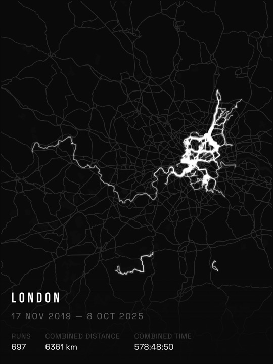
- Density is the art. 30+ runs in one city is where the layering starts to look intentional; hundreds looks spectacular. (A handful of runs reads better as individual route posters.)
- One city per poster. Mixing cities zooms the map out until everything is a smudge. Make one per city and hang them as a series.
- Rides and hikes count too. Anything with a GPS track can go in — some of the best-looking maps mix run density with a few long rides reaching out of town.
FAQ
Can I include every activity type?
Yes — runs, rides, hikes and walks from your Strava history all work.
Is my Strava data stored?
Activities are loaded to render your poster, not resold or published. See the privacy policy for specifics.
Can I get just the file, without ordering a print?
Yes. The HD export is free and arrives by email — printing through RunInk is optional.
What if my runs are split across two cities?
The city filter groups them automatically — make one poster per city, or use the date filter to slice a specific era instead.